


Deskripsi Austrian Map mobile
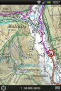
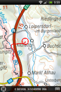
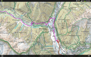
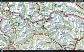
The Austrian Map mobile (AMap mobile) contains the digital maps of Austria including hill shading, geographic names database “Geonam” and the digital elevation model. This digital product of the Bundesamt für Eich- und Vermessungswesen (BEV) offers high quality topographic maps and a user-friendly interface with extensive functionality.
Maps and data available in the Austrian Map mobile:
* Overview Map 1:1 Million (free of charge)
* Cartographic model 1:500 000 (free of charge)
* Cartographic model 1:250 000
* Cartographic model 1:50 000
The app contains a map tile contingent of 550 tiles, which corresponds to 550 km ² in the scale 1:50 000 (no specific area, maps free to choose). This allows to test the capabilities of the AMap mobile in a specific area. Additional areas may be downloaded at will.
Functions of Austrian Map mobile:
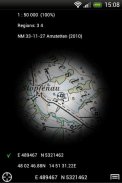
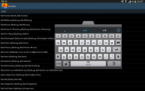
* Search by toponym or search by coordinates
* GPS features: Display of the location, "moving map", compass support, routing along tracks
* Insert, edit and share POIs (Points of Interest)
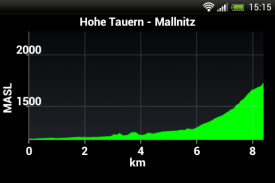
* Recording and exporting tracks (tracks can be imported into AMap Fly)
* meta data about the used map sheets
Austria Peta mobile (AMAP mobile) berisi peta digital dari Austria termasuk bukit shading, nama geografis database "Geonam" dan model elevasi digital. Produk digital ini dari Bundesamt für Eich- und Vermessungswesen (BEV) menawarkan peta topografi berkualitas tinggi dan antarmuka yang user-friendly dengan fungsi yang luas.
Peta dan data yang tersedia dalam ponsel Austria Peta:
* Ikhtisar 1: 1 Juta (gratis)
* Kartografi Model 1: 500 000 (bebas biaya)
* Kartografi Model 1: 250 000
* Kartografi Model 01:50 000
Aplikasi ini berisi kontingen peta genteng dari 550 ubin, yang sesuai dengan 550 km ² dalam skala 1:50 000 (ada daerah tertentu, peta bebas untuk memilih). Hal ini memungkinkan untuk menguji kemampuan mobile AMAP pada area spesifik. Area tambahan dapat di-download di akan.
Fungsi dari Austria Peta seluler:
* Cari berdasarkan toponim atau pencarian dengan koordinat
* Fitur GPS: Tampilan lokasi, "peta bergerak", dukungan kompas, rute sepanjang trek
* Insert, mengedit dan berbagi POIs (Points of Interest)
* Merekam dan mengekspor trek (track dapat diimpor ke AMAP Fly)
* Meta data tentang lembaran peta digunakan
Austrian Map mobile - Versi 2.1.3
(20-10-2022)Austrian Map mobile - Informasi APK
Versi APK: 2.1.3Paket: com.garzotto.ammaAplikasi pada kategori yang sama
Anda juga mungkin suka...


